Classic
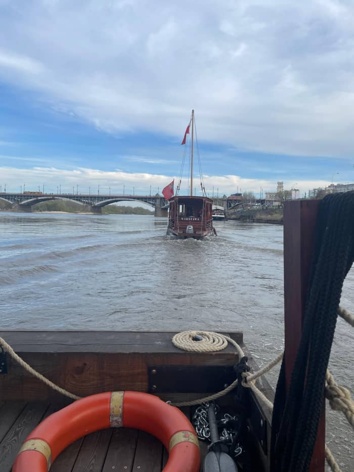
Galar cruise
Wooden boat, audio guide
- Length54 minutes
- MeetsMarina Warszawa
- Boat12 seats
Where is your stop
Check out 37 stops
Select a route, then tap a marker or stop to see its note and open Google Maps.
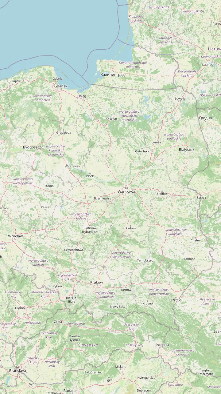
The Vistula's source streams rise on its western slope, at 1107 m and 1080 m above sea level.
Google MapsThe dam and reservoir in the town of Wisła, just below where the source streams meet.
Google MapsNear Kraków the river cuts a gorge through limestone at the Kraków Gate.
Google MapsThe end of the upper course, where the San joins the Vistula.
Google MapsThe narrowest and deepest part of the Vistula gorge, with 80 to 100 m between the valley floor and the plateau.
Google MapsThe capital's unofficial 19th district: boulevards on the left bank, a Natura 2000 area on the right.
Google MapsWhere the Narew joins and the middle course of the Vistula ends.
Google MapsA cathedral town high above the lower Vistula, between Modlin and Włocławek.
Google MapsThe dam here holds back Poland's largest reservoir by area.
Google MapsWhere the Vistula reaches the Gdańsk Bay of the Baltic Sea.
Google Maps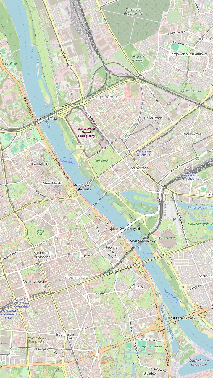
The brown double-decker barge about 300 m north along the boulevard from the Copernicus Science Centre stairs, where the galar cruises check in.
Google MapsA hands-on science centre where you run the experiments yourself; its free roof garden looks over the river and the stadium.
Google MapsA free roof garden, one of the largest of its kind in Europe; the upper garden closes from November to March.
Google MapsA pedestrian and cycling bridge, 452 metres long, opened in 2024.
Google MapsNamed on the galar route this site sells, on the way to the Old Town panorama.
Google MapsThe castle above the river, one of the sights the galar route names.
Google MapsAt the foot of the Old Town: water, light and laser shows on summer weekend evenings; the Wilga ferry leaves from the Podzamcze pier nearby.
Google MapsThe northern end of the inter-bridge zone, one of the best stretches for birdwatching.
Google MapsAfter dark the Dzielnica Wisła neon sign hangs underneath; the most photographed Mermaid statue stands close by on the boulevard.
Google MapsBuilt over 100 years ago, with Mermaids on its tower and on the benches above the pillars.
Google MapsBuilt for the 2012 European Football Championship; at night it shimmers white and red.
Google MapsOn the right-bank stretch of the galar route this site sells.
Google Maps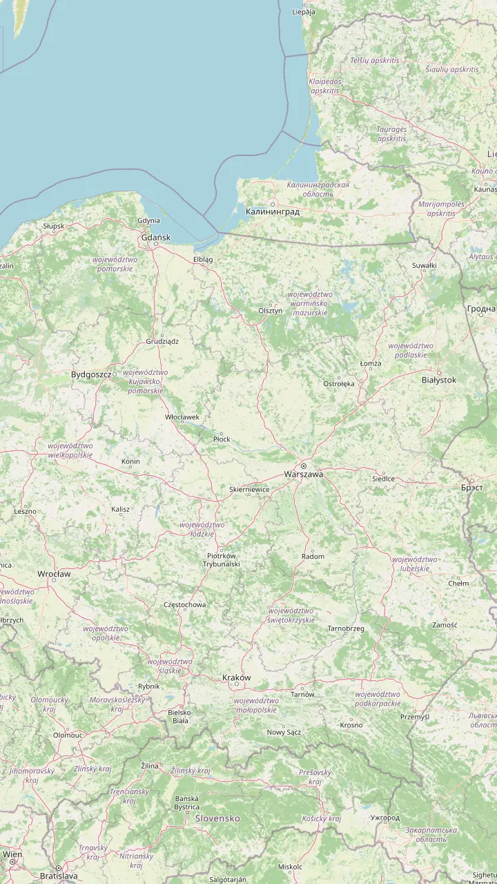
The capital of Polish rafting, where the Tanew meets the San; in 1993 its raftsmen covered 724 km to Gdańsk in 26 days.
Google MapsThe cathedral tower shows a raftsmen's clock with a single hand on its river side.
Google MapsGrain stored in these granaries on the Brda was loaded onto barges for Gdańsk.
Google MapsMonumental granaries reflected in the Vistula, best seen from the Klimek Tower.
Google MapsPoland's largest museum of the river's history; the permanent exhibition is free on Saturdays.
Google MapsOne of Europe's oldest and largest harbour cranes; its treadwheels lifted loads of up to 4 tonnes.
Google MapsIn 1643 the port of Gdańsk had 315 granaries; 3 rebuilt ones on this island now house the maritime museum.
Google Maps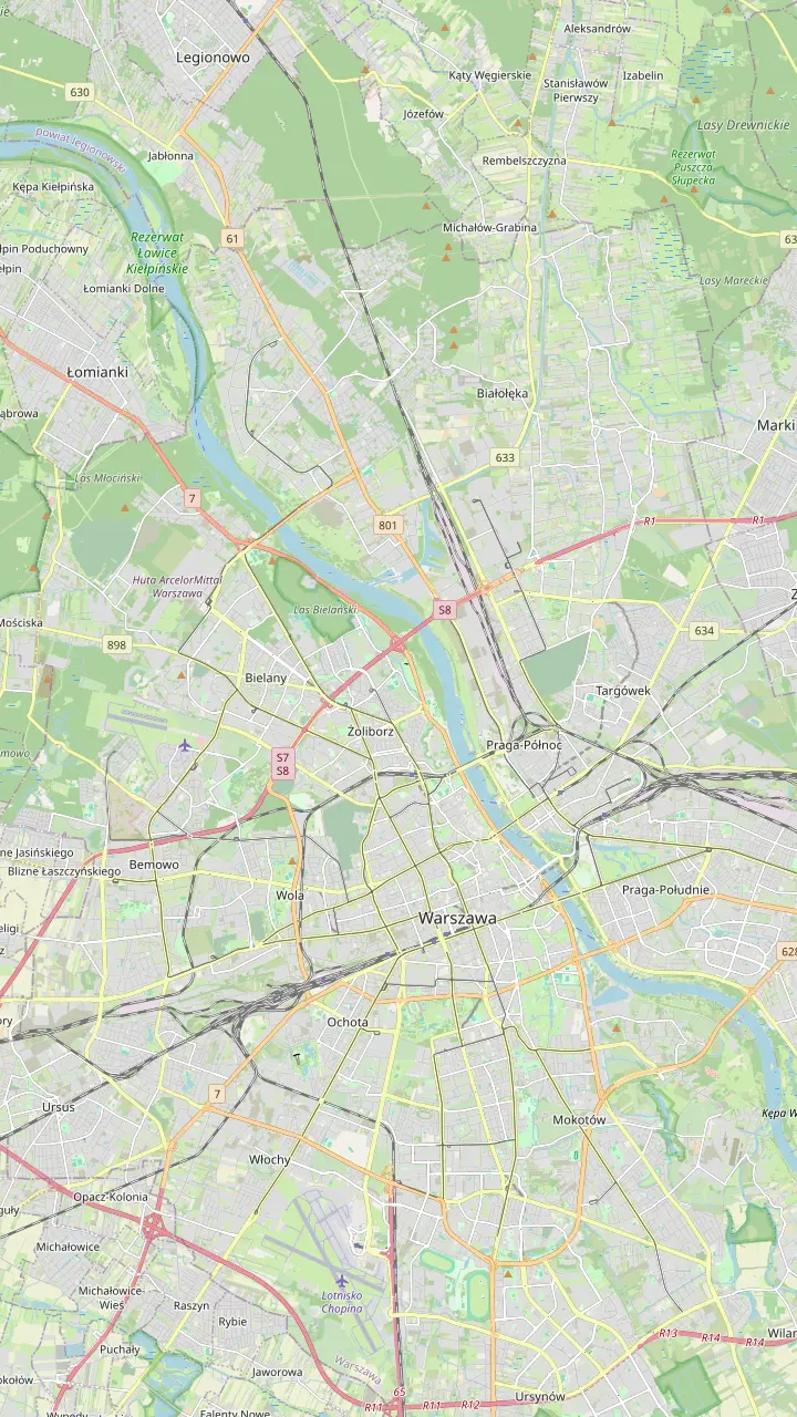
The W1 Słonka ferry crosses from Cypel Czerniakowski to Saska Kępa beach and takes 21 passengers.
Google MapsA quieter beach near the Łazienkowski Bridge, reached on foot or by the Słonka ferry.
Google MapsThe W2 Pliszka ferry crosses from the Poniatowski Bridge waterfront to Poniatówka.
Google MapsThe most popular beach in Warsaw, under the Poniatowski Bridge near the stadium.
Google MapsA beach near the Zoo with a view of the Old Town; the W3 Wilga ferry lands here.
Google MapsThe landing for the Dudek ferry across to Tarchomin, on the northern edge of the city.
Google MapsRent kayaks, paddleboards, rowing boats or a small motorboat that needs no licence.
Google MapsOne of the urban beaches where the Warsaw Beach Host lends sun loungers, balls and toys.
Google Maps© OpenStreetMap contributors, map data
What river runs through Warsaw, where it rises, where it meets the Baltic, how deep it really is in the city and why its wild right bank surprises every visitor.
Editorial team, warsawrivercruise.click · Updated November 9, 2026 · Reading: 8 min
Essentials
If you are wondering what river runs through Warsaw, it is the Vistula, Wisła in Polish: the longest river in Poland at 1047 km, and the longest of all the rivers that flow into the Baltic Sea.1 It cuts the capital in half. On the left bank stand the Old Town, the center and the boulevards; on the right bank lie Praga, the beaches and a ribbon of riverside forest. The Polish Tourism Organisation even calls the river Warsaw's unofficial 19th district.6
The tourist office says you will not find a river like this in other European capitals,7 and that right bank is what sets it apart. It is protected under Natura 2000 as habitat for threatened breeding birds,5 so while the city shore has promenades, cafés and concert stages, the opposite shore is sand, willows and woodland. From a boat in the middle of the stream you see both at once, which is the best argument for a cruise even if you have already walked every metre of the boulevards.
The river is far more than scenery. The Greenery Authority notes that Warsaw draws its tap water from the Vistula and needs the river to run the city's heat and power plant.8 Around the capital several other rivers converge on it: the Bzura from the left, and from the right the Narew together with the Bug and the Wkra.9 Standing on a bridge here, you are looking at a meeting of waters as much as at a city river, and the color of the current changes with the seasons.
So where does the Vistula River start and end? It begins high in the Silesian Beskids, where 2 small streams, the Czarna Wisełka and the Biała Wisełka, rise on the western slope of Barania Góra at 1107 m and 1080 m above sea level.2 Just below the point where they meet, in the town of Wisła, a dam holds back the Czerniańskie reservoir.14 From there the young river leaves the mountains and heads for Kraków, still small enough that you could hardly picture it under Warsaw's bridges.
Geographers split its course into an upper, a middle and a lower part. The upper course runs from the source to the mouth of the San near Zawichost, the middle course from Zawichost to the mouth of the Narew near Modlin, and the lower course from Modlin to the Baltic.11,15 On the way it cuts a gorge through limestone at the Kraków Gate,10 and near Kazimierz Dolny the floor of its valley lies 80 to 100 m below the plateau.12 Warsaw sits on the middle course, before the Narew arrives.
It ends in a delta. North of Warsaw the river passes the dam at Włocławek, which holds back Poland's largest reservoir by area,16 and in the north it fans out into the Żuławy delta, about 50 km long and covering about 1700 km².17 Finally the Vistula flows into the Gdańsk Bay of the Baltic, with a mean annual flow of 1047 m³/s at its mouth.3 The figure is easy to remember: it is the same as the river's length in kilometres, a neat coincidence that makes both numbers stick.
How deep is the Vistula River in Warsaw? The honest answer is that it changes from place to place and from month to month. The Greenery Authority explains that the gauge on the central boulevards is read against an agreed zero and does not show the depth of the river.24 On 28 August 2025 that gauge showed an alarming 7 cm, yet the navigation channel still held several metres of water.4 A gauge reading in the news is a trend line, not a depth chart.
Flow tells you more than the gauge. At that low point the river was still moving 159 cubic metres per second through Warsaw, against a record low of 113 m³/s in 1921 and 153 m³/s in 1951.18,19 Even at its lowest the Vistula keeps a strong current, and the authority is blunt about it: walking across from bank to bank is never possible.25 Treat the sandbars that appear in late summer as islands to look at, not as a way over.
Shallow water shapes how the river is used. Traditional boats with a shallow draught have run full-day cruises even when the level fell to 20 cm,26 while large cruise ships are few and are often kept in port by low water.27 The city's free Kopernik water tram has had to suspend its reservations because of low water.28 The practical upshot: the Warsaw Vistula is a river for short trips on light boats, not for long voyages on big ships.
Your river day
Choose by what you want to see and how near the waterline you want to get.
If I want the classic view
Book the galar cruise
54 minutes past the Old Town, the bridges and the stadium.
If I want to paddle
Join a packraft tour
2 hours with an instructor, up to 6 people.
If I want birds
Walk the inter-bridge zone
Among the best birdwatching areas on the Warsaw river.21
If I want the wild bank on foot
Take the right-bank path
Over 20 km from the Siekierkowski Bridge to the city edge.22
If I want the whole river
Travel to the source
Barania Góra in the Silesian Beskids.2
Meet the river
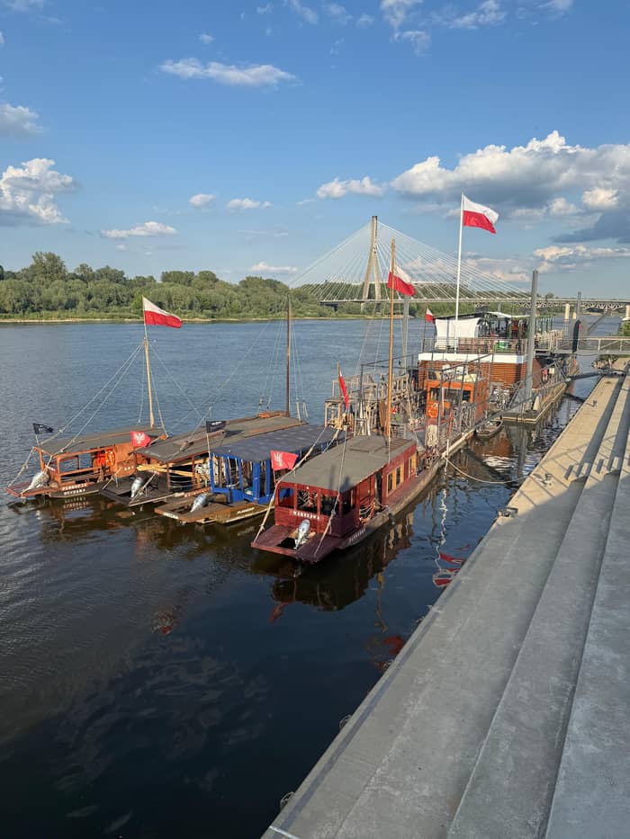
Classic
Wooden boat, audio guide
Active
Paddle with an instructor
Social
Your playlist past the wild bank
In Warsaw the river runs past kilometre 511 of its course, at Płyta Desantu on the Vistula Flotilla Boulevard.13 The left bank is lined by 5 kilometres of boulevards, with cafés and restaurants on moored barges.20 Fragments of destroyed Warsaw bridges, pulled out of the riverbed, are displayed along the promenade,66 a quiet reminder of what this water has lived through, and a good place to pause before you walk down to the quays.
Follow the Praga shore between the Gdański and Łazienkowski bridges and you pass 6 Warsaw bridges and several beaches.67 The newest crossing is the Magdalena Abakanowicz footbridge, 452 metres long, opened in 2024 for walkers and cyclists.34 The Poniatowski Bridge, built more than 100 years ago, carries Mermaid figures on its tower and on the benches above its pillars.39 Each bridge frames the river differently, and from the water you pass under several of them.
Cross over and the city falls away. A walking and cycling path of over 20 km runs along the right bank from the Siekierkowski Bridge to the edge of Warsaw,22 past sandy beaches such as Poniatówka, the most popular of them.56 In summer free ferries link the banks whenever the water level allows,64 so you can walk the boulevards on one side and come back through the riverside woods on the other. Few capitals let you swap a café terrace for a forest path in a few minutes.
Price your trip
Pick a way onto the river and set your group size.
Look at 4 options
Pick a way onto the river and set your group size.
≈
View≈
View≈
View≈
ViewFigures are GetYourGuide from-prices, translated at the ECB reference rate. The booking step shows what you pay exactly.
Down the river
Barania Góra
They rise at 1107 m and 1080 m.2
Kraków
The river breaks through the Kraków Gate.10
Zawichost
The upper course ends here.11
Kazimierz Dolny
80 to 100 m from the valley floor to the plateau.12
Warsaw
Kilometre 511 at Płyta Desantu.13
Gdańsk Bay
The river reaches the Baltic Sea.3
The Greenery Authority estimates that around 230 species of birds visit Warsaw,68 and for many of them the Vistula is a major migration corridor.23 The Middle Vistula Valley Natura 2000 site, code PLB 140004, protects the floodplain,69 and it is Poland's most important breeding ground for the common sandpiper, the little tern, the grey gull and the ringed plover.70 All of this sits a short walk from the Royal Castle, which is what makes the setting so unusual.
You do not need to be a birder to notice the wildlife. On the quieter stretches of the right bank you may see herons, cormorants and kingfishers,63 and on the Praga bank you can even meet beavers.71 The best areas for birdwatching are the inter-bridge zone between the Grota-Roweckiego and Gdański bridges, the river below the Siekierkowski Bridge and the islands north and south of the city.21 Bring binoculars, move slowly and keep your voice down.
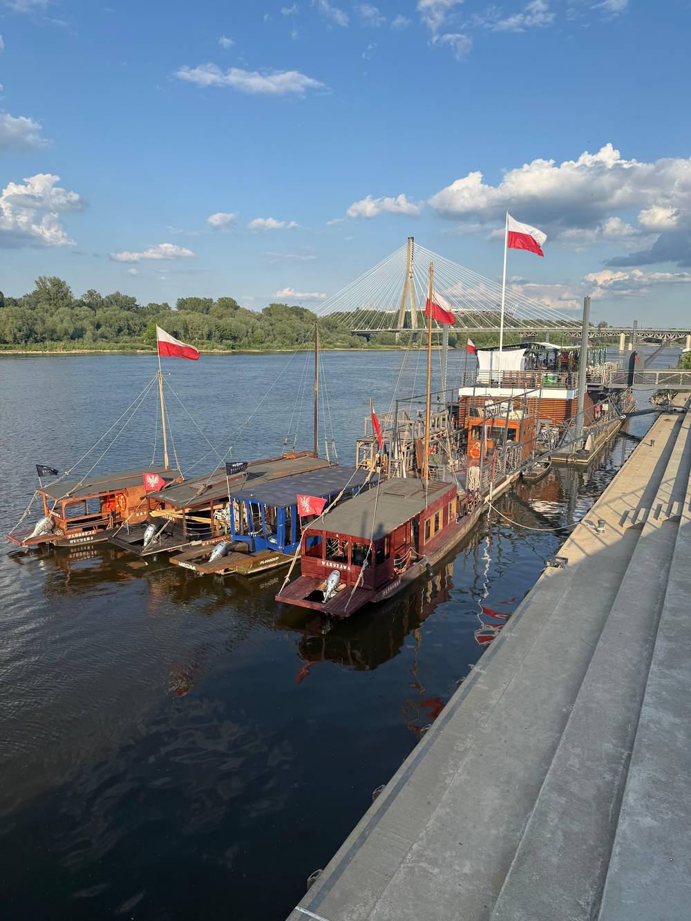
The city has worked to keep the bank wild. A LIFE+ project that ran from 2011 to 2018 created a permanent island of several hectares, plus sandbanks and floating islands, for nesting terns.72 The Kamień Educational Pavilion is now the authority's main center for teaching people about the river's nature.65 From a galar, whose flat bottom gives it direct access to the Vistula's beaches,73 the wild shore can feel close enough to touch.
Video
wocomoTRAVEL on YouTube · Playback files load only once you tap play.
The Vistula is also an extremely important migration corridor, making it an excellent place for wildlife watching.
By the river
The Vistula is a natural river with natural moods. Below Puławy it still wanders freely, and in spring high water floods the riverside fields and meadows.74 In late summer the opposite happens and the level drops, and the tourist ferries run only as long as the water level allows.75 Plan a river day with both moods in mind: spring brings broad brown water and drifting branches, late summer brings beaches, sandbars and slower boats.
The river also gave Warsaw its symbol. In one legend the Mermaid swam in from the Baltic, was so taken with the city that she stayed, and after Warsaw fishermen freed her from a greedy merchant she promised to defend it.76,77 On the city seal of the early 15th century she looked nothing like a mermaid, more like a winged monster with clawed paws and a lion's tail.78 Over the centuries she lost the wings and gained a fish tail, but she kept her sword and shield.
Today she waits for you by the water: the best-loved Mermaid figure, beside the Świętokrzyski Bridge just off the boulevards, wears the face of the Warsaw poet Krystyna Krahelska.38 The galar cruise this site sells names the Mermaid monument on its route, so you can wave to her from the deck and then climb the stairs to meet her in person. A spot on the riverbank is a fitting home for the guardian of a river city.
FAQ
Poland's longest river, 1047 km from the Beskids to the Baltic.1
It is Poland's longest river and the longest flowing into the Baltic.1
Its source streams rise on the western slope in the Silesian Beskids, at 1107 m and 1080 m.2
The river keeps a strong current even when the city gauge reads only a few centimetres.25
The Polish Tourism Organisation calls it a natural, fast-changing river; stick to designated activities.61
Large cruise ships on the Vistula are few, and low river levels often stop them sailing.27
Sources
Planning an hour on the Vistula? Ask a real person here.